Why Tehachapi?
Mountain Valley Airport sits at the convergence of three major geographic features: the Sierra Nevada to the north, the Tehachapi Mountains to the west, and the Mojave Desert to the east. This creates a unique combination of lift sources that few sites in the western US can match.
Thermals — Summer thermals are strong and reliable, with bases typically reaching 12,000–16,000+ feet MSL. The Owens Valley corridor north of the field is one of the best thermal soaring environments in the world.
Ridge lift — The Tehachapi range offers excellent ridge running when winds are from the west or northwest.
Wave — Mountain wave is possible when conditions align, particularly with strong westerly flow over the Tehachapis.
Typical Cross-Country Routes
The classic Tehachapi XC route runs north up the Owens Valley toward Lone Pine and beyond. On strong days, pilots routinely fly 200–400+ km out-and-returns along the Sierra. Triangles incorporating the Tehachapi ridge, the Piute Mountains, and the Owens Valley are also popular.
July 2025 Flights from Mountain Valley (WeGlide)
Here's what a month of summer flying looks like from L94. This map shows all flights uploaded to WeGlide during July 2025 — notice the heavy traffic up the Owens Valley corridor toward Lone Pine, Eastern Sierra, and beyond.
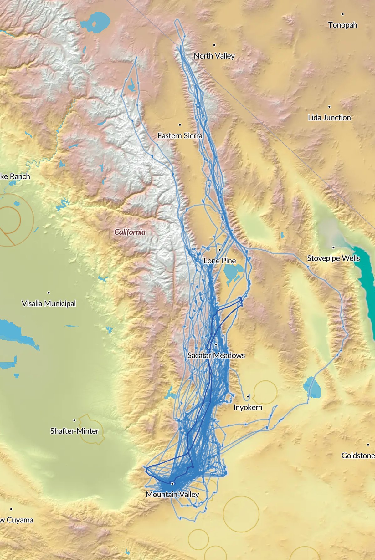
All WeGlide flights from Mountain Valley Airport (L94), July 2025. Source: weglide.org
The Airfield
Mountain Valley Airport (L94) is a privately owned, public-use airport at 4,220 feet MSL. Two parallel asphalt/dirt runways (9L/27R and 9R/27L) at about 4,890 feet long. Skylark North operates three Pawnee tow planes and has been the primary glider operation here for decades.
Weather Resources
Skylark North has live webcams on their website. The nearest METAR is from Tehachapi Municipal (KTSP), 2 miles north. For soaring forecasts, check SkySight, RASP/DrJack, or the Windy.com thermal layer.